ID card printing in Jumla (जुम्ला)
Order personalised student and staff ID cards online for your school, college or organisation in Jumla district, including Chandannath. Choose a template or upload artwork, approve the proof and we deliver from Patna to your campus.
जुम्ला जिल्लाका विद्यालय, कलेज र कर्मचारीहरूका लागि परिचयपत्रको अनलाइन कोटेसन लिनुहोस्। डिजाइन, नाम र फोटो पठाउनुहोस्; छाप्नुअघि प्रुफ र डेलिभरी पुष्टि गर्नुहोस्।
- School ID cards from ₹25
- College ID cards from ₹30
- Employee ID cards from ₹40
- Printed lanyards from ₹15
- All prices ↗

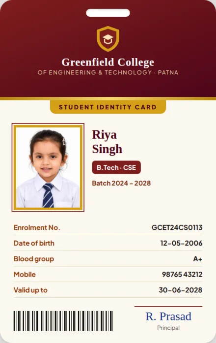
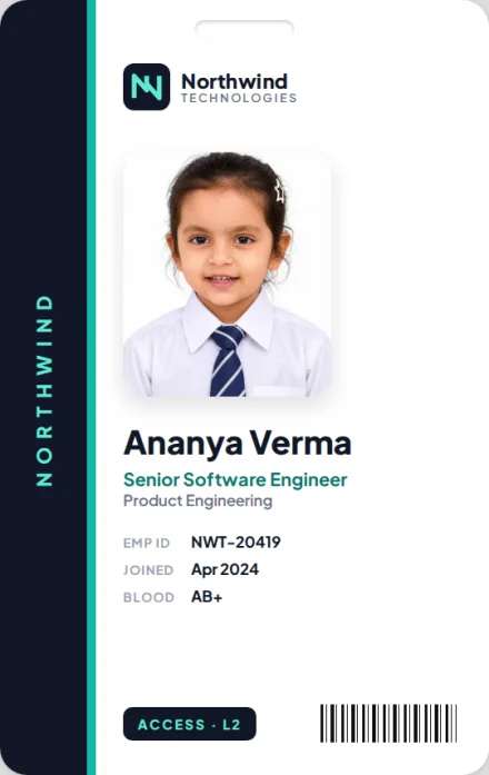
No shop visit needed. Order from Jumla, Nepal on your phone, approve a digital proof on WhatsApp, and get your cards by courier from our Patna print unit.
- ✓ Proof before printing
- ✓ Pay only after the quote
- ✓ Tracked courier
Get a price for Jumla, Nepal
No account needed. We reply on call or WhatsApp with an exact quote.
Jumla: quick facts
- District
- Jumla, Karnali Province · headquarters Jumla · population 118,349 (2021 census)
- Local levels
- 1 municipality and 7 rural municipalities (gaunpalikas), 60 wards in all.
- Border crossing
- Nearest main India–Nepal crossing: Nepalgunj (Rupaidiha), about 145 km in a straight line from Jumla.
- From our print desk
- Patna is about 510 km away in a straight line. Road distance, route and delivery charge are confirmed in your quote.
- Dispatch
- From Patna within 5 working days of proof approval and payment.
- Minimum order
- 20 cards for school ID cards.
Every municipality and gaunpalika in Jumla
Expand a municipality or gaunpalika to see its wards, former VDCs and villages.
Cities and municipalities
Chandannath चन्दननाथ · Municipality · 10 wards
चन्दननाथ नगरपालिका · Wards 1–10 · population 21,036 (2021) · 102.03 km² · official website
Formed from the former VDCs / municipalities: Chandannath, Kartikswami, Mahatgaun, Talium.
- Acharya Bada
- Bagar
- Bans
- Barkotegaun
- Bayal Katiya
- Bhadali
- Bhandari Bada
- Bhangkhal
- Bijayanagar
- Bohara Bada
- Boharagaun
- Burtha Bada
- Chaukhandi
- Chauriyachaur
- Chhina
- Chimani
- Chyudya
- Chyuri
- Dasanta
- Devkota Bada
- Dhakani
- Dhimichaur
- Gairagaun
- Galakot
- Ghamdanda
- Ghughuti
- Gothali
- Jaj
- Jatibhid
- Kalatad
- Khalachaur
- Khalangga Bajar
- Khalla
- Kholikot
- Kotha
- Kotila
- Kuduska
- Mahatgaun
- Malabhid
- Malika
- Micha
- Paninaula
- Phanchaur
- Pipalgaun
- Raharikhel
- Rajikot
- Rana
- Rana Rawat
- Ratadhunga
- Ratamata
- Ratanchaur
- Rokaya Bada
- Sarayapani
- Shri Dhuska
- Silam
- Simkhada
- Sinemul
- Sinhachaur
- Siyal Bada
- Talcha
- Talichaur
- Talium
- Thapaswanra
- Thapla
- Tharpedhunga
- Umgad
Rural municipalities (gaunpalikas)
Guthichaur गुठिचौर · Rural Municipality · 5 wards
गुठिचौर गाउँपालिका · Wards 1–5 · population 10,922 (2021) · 427 km²
Formed from the former VDCs / municipalities: Depalgaun, Garjyankot, Gothichour.
- Airanchaur
- Badi Lek
- Baiseni Salla
- Besi
- Bhalu Lagna
- Bhir Kanda
- Bhittakholagaun
- Binggare
- Chauthara
- Chhopagaun
- Chotra
- Chukeni
- Dansanghu
- Dauthichaur
- Depalgaun
- Deuli Patan
- Dhateli
- Dhawalpur
- Dhitagaun
- Dhungikhola
- Dhura Kanda
- Dillikot
- Dochal
- Dudakhocha
- Gadigaun
- Gajimela
- Garjyangkot
- Gothichaur
- Gothichaur Lagna
- Gothigaun
- Guthichaur[Bhedi Farm]
- Hankathanachaur
- Himri Patan
- Jaldhunga
- Jandhara
- Jarkuna Patan
- Jarkunadanda
- Jhimare
- Jundhara
- Khali
- Khallal Bada
- Khambachaur
- Khandara Goth
- Khodekhola
- Kudigaun
- Kumdi
- Kuri Santha
- Lagna
- Lamachaur
- Mahadev
- Majh Dolaghat
- Mani Sangu
- Manigaun
- Mathillo Dolaghat
- Mattbarechaur
- Murligaun
- Napani
- Naula
- Nauli
- Naumuli
- Ogreni
- Phoi
- Piraure
- Pyankure Bada
- Rakalbathan
- Ratamata
- Ratapani Lek
- Sampu Bada
- Sandepani
- Sarki Bada[Gadpari]
- Sim
- Surlute
- Syalipakha
- Tallo Dolaghat
- Thakna
- Ukhadi
Hima हिमा · Rural Municipality · 7 wards
हिमा गाउँपालिका · Wards 1–7 · population 12,191 (2021) · 132.32 km²
Formed from the former VDCs / municipalities: Badki, Kalika, Mahabai.
- Acharya Lihi
- Aindakot
- Badki
- Bakhre
- Balchaur
- Banj Gadgaun
- Barekot
- Basthapla
- Bollechaur
- Buwa
- Chanulekharka
- Chema
- Danda Bada
- Deargaun
- Dhanchugaun
- Dhandkharka
- Dholdhunga
- Gunibhid
- Jarjali
- Jarji
- Jogi Bada
- Jol
- Khadu
- Khaldhunga
- Khukel
- Koireli
- Kot
- Kudu
- Kutu
- Lipi
- Mahadev
- Mahat Bada
- Mainapori
- Maleokandh
- Marchi
- Masandanda
- Mastamadau
- Mophala
- Nundina
- Odigaun
- Patharkholagaun
- Porkha
- Rapti
- Ratapula
- Rupichhada
- Sano Chiudi
- Sel
- Shergaun
- Simkot
- Simtali
- Tagune
- Tallakhet
- Tarebhid
- Thapakhet
- Thulakholagaun
- Thulo Chiudi
- Tikimala
- Totke Salla
Kanaka Sundari कनकासुन्दरी · Rural Municipality · 8 wards
कनकासुन्दरी गाउँपालिका · Wards 1–8 · population 13,625 (2021) · 225.39 km²
Formed from the former VDCs / municipalities: Birat, Bumra Madichour, Kanaksundari (Choutha), Malikabota (Hatsinja), Pandabgupha.
- Angaun
- Baduwal Bada
- Barkote Bada
- Bhadagaun
- Bharbhare
- Bhatta Bhandarigaun
- Bhiunaula
- Bhuje Tauka
- Bota
- Budu
- Bulbule
- Bumra
- Chauki
- Chautha
- Dante Okhar
- Dehar Patha
- Dhaulapani
- Dhobighat
- Dilechaur
- Gani
- Gauri
- Goru Odar
- Gothel Bada
- Hatsinja
- Himdhuski
- Ipi
- Jhawate Bada
- Jhawati
- Jhulani
- Jiangaun
- Jodel Bada
- Kalakanda
- Kanda
- Kapra Odar
- Kham
- Kholigaun
- Kot
- Kudilla
- Kurke
- Laha
- Laharja
- Lamji
- Larja
- Ledi
- Lekhpor
- Ludkugaun
- Lum
- Mahadev
- Majh Budu
- Manjau
- Marphan
- Mel Bisauna
- Mere
- Musedani
- Naudhunga
- Neta
- Odam Goth
- Okharpata
- Pher
- Phutasili
- Pyakuri
- Randhai
- Ranisain
- Riya
- Rokaya Bada
- Rotgaun
- Sagpalla
- Sahu Bada
- Samarkholi
- Sanjyal Bada
- Seri
- Simpati
- Sipti
- Tallo Lekhpor
- Tallo Ranisain
- Thada
- Tharmari
- Thum
- Uwa Odar
Patarasi पातारासी · Rural Municipality · 7 wards
पातारासी गाउँपालिका · Wards 1–7 · population 16,824 (2021) · 814.07 km²
Formed from the former VDCs / municipalities: Chhumchour, Dillichour, Patarasi, Patmara.
- Adhyauli
- Bata
- Ber
- Bheri Bata
- Bhotgaun
- Bhuinseri
- Bijora Hiu Chuli
- Chanpekholagaun
- Chare Bhir
- Charkholagaun
- Chaure
- Chaurgaun
- Chhara
- Chhatana
- Chhumgaun
- Chisakholagaun
- Dab
- Deuchaur
- Deunari
- Dhalapa
- Dhamta
- Dhune
- Dhupirukh
- Dillichaur
- Dosa
- Gahun Dunna
- Gairachaur
- Gere
- Ghodasaingaun
- Golrukh
- Gopatali
- Here
- Huriban
- Hurigaun
- Japna
- Jharal Paira
- Jimale
- Kage Bada
- Kamar Pata
- Karaunsi
- Kasi Dalpha
- Khala Dhik
- Kharsa
- Kilahannechaur
- Kodhuska
- KuiriDaha
- Kureli
- Lade Hau Chuli
- Lagna
- Lamri
- Lanni
- Lasi
- Leti Langna
- Luchu
- Lum
- Maharigaun
- Mandhara
- Matachaur
- Mathillo Lorpa
- Nanichaur
- Nauli
- Obregadgaun
- Pachhejhar
- Pairata
- Palta Thumba
- Patmara
- Pere
- Puchchha
- Rat Thumka
- Rini
- Salim
- Seli
- Sim
- Siyalgadhi Chuli
- Sungur Daha
- Syanla Phal
- Syanlagadhi
- Tallo Lek
- Tallo Lorpa
- Talphi
- Thingke
- Thulchaur
- Tirkhu
- Tirkhu Jiula
- Upallo Urthu
- Urthu
Sinja सिंजा · Rural Municipality · 6 wards
सिंजा गाउँपालिका · Wards 1–6 · population 12,556 (2021) · 153.29 km²
Formed from the former VDCs / municipalities: Dhap, Khanigaun, Narakot.
- Agasthi Bada
- Agasthi Bada Goth
- Bahun Jyula
- Baidhara
- Banne Bada
- Baregaun
- Bhadechankha
- Bhadgaun
- Bhakemul
- Bhuli
- Bista Bada
- Budbude
- Buwa
- Chakha
- Chhani Gada
- Chulelgaun
- Chuphekharka
- Damaimare
- Dhapa
- Dhita Lihi
- Dhodenga
- Digra
- Dike
- Dilauri
- Ganepane Bada
- Garja
- Ghari Bada
- Ghodekot
- Goragaun
- Jacha
- Jala
- Jodugaun
- Kandagaun
- Kantai
- Kedarnath
- Khali
- Lima
- Ludu
- Lunde
- Mahadev Bada
- Mahanganga
- Musedhunga
- Nainalmadu
- Narakot
- Pahada
- Patchaur
- Patikholagaun
- Pharse Bada
- Phunggragaun
- Pigi
- Pyahelchaur
- Pyakude Bada
- Ranukhana
- Rugagaun
- Rupakot
- Sanglipata
- Setkamul
- Shanigaun
- Shera
- Syaule
- Tallo Garja
- Tallo Guthi
- Thar Bista Bada
- Thuli
- Turture
- Tuture
- Upallo Bhadgaun
- Upallo Guthi
- bhade Chakha
Tatopani तातोपानी · Rural Municipality · 8 wards
तातोपानी गाउँपालिका · Wards 1–8 · population 15,575 (2021) · 525.56 km²
Formed from the former VDCs / municipalities: Haku, Lamra, Tamti, Tatopani.
- Bai Ranka
- Banbira
- Banchari Bichiya
- Baragaun
- Bhujeni
- Bhuli
- Budbudi
- Bura Bada
- Chakhachaur
- Chaurkanda
- Chausila
- Chilime Tauko
- Dangi Bada
- Dhaulapani
- Dungri
- Dusilya
- Gadapari
- Gaiseri
- Gotam Bada
- Hanku
- Hiyakholagaun
- Hiyankholagaun
- Jagadi
- Jayatpur
- Jhadgidi
- Kaim
- Khadag Bada
- Khajarmi
- Khapla Ban
- Kharmata
- Kimruk
- Kukude Khod
- Laghu
- Lamra
- Litakot
- Machhale Dev
- Machhali
- Mahadev
- Majh Patan
- Naula
- Nayapani
- Nuwaghar
- Pande Bada
- Phanchaur
- Puwarkholi
- Rada
- Rakasim
- Rami Jyula
- Ranka
- Rankasim
- Raut Bada
- Sarmi
- Serabhid
- Sundargaun
- Supakuna
- Surki
- Tamti
- Tara Daha
- Tatopani (Jarmi)
- Tharalegaun
- Topla
- Umlya Tauka
Tila तिला · Rural Municipality · 9 wards
तिला गाउँपालिका · Wards 1–9 · population 14,539 (2021) · 175.49 km²
Formed from the former VDCs / municipalities: Kundari, Lihi, Mahadev, Malika.
- Barasthan
- Bhatchaur
- Bhenchaur
- Chulakot
- Dandali
- Dani Bada
- Dhanda
- Dharsakandh
- Dhimkot
- Dhipu
- Dhungri
- Gadchaur
- Gadeni
- Ghode
- Ghodesin
- Gothi
- Gumtha
- Humto
- Jagatikholagaun
- Jaulakot
- Jogi Bada
- Kailash
- Kathina
- Kholigaun
- Koireli
- Kot
- Kudari
- Kukudekhet
- Kunapata
- Larmi
- Lihi
- Lihi Syala
- Lila Katiya
- Lumshera
- Malapani
- Manchaur
- Manhachaur
- Mathillo Ghede
- Mulli
- Naga
- Nangad
- Nuwakot
- Pani Naula
- Patankhet
- Patar Sagu
- Pokhari
- Puru
- Purukandh
- Radeudanda
- Raksipata
- Ransa
- Rapu
- Rara
- Raut Bada
- Rawat Bada
- Ripi
- Salleni
- Sanpulli
- Sapuli
- Sau Odar
- Sera
- Sheri
- Simkholakhet
- Sitanagar
- Sudi
- SyalaLumshera
- Thanisim
- Thapagaun
- Tunhi
- Tunikholagaun
Cannot find your village? Write your full address with municipality or gaunpalika and ward number when you request a quote. A matching directory entry is not required to enquire.
Sources: Survey Department of Nepal and UN OCHA, Nepal Subnational Administrative Boundaries (CC BY-IGO; district code NP0663); ward counts from the Central Bureau of Statistics ward-level list of the 753 local units (2017); population (2021 census), area and Nepali names from Wikipedia; villages and former VDCs from OCHA Nepal, Settlements in Nepal, placed in today's local levels by their coordinates. Retrieved 24 October 2026. Spellings follow these records and may differ from local usage; they do not certify boundaries, school presence or delivery availability.
Plan a school ID-card order for Jumla
- Choose the card: compare school ID cards, college and staff options, or a card, holder and lanyard set.
- Prepare your files: school logo, design, student names (in English, Nepali or both), class, roll or ID numbers and labelled photos. Use the bulk-order checklist.
- Give the full address: school name, tole or village, ward number, municipality or gaunpalika, district and a contact phone for delivery.
- Review the quote and proof: check spellings, photos, quantity, delivery charge, any import duty or VAT and the agreed timeline before approving printing.
Questions from Jumla
बारम्बार सोधिने प्रश्नहरू
Can a school in Jumla order ID cards online?
Yes. Select a template or upload your design, send the student list and photos, and request a quote. Confirm the proof, payment and delivery before printing.
How do cards reach Jumla?
They are printed in Patna and sent across the India–Nepal border; the nearest main crossing for Jumla is Nepalgunj (Rupaidiha). The delivery route, charge and date for your campus address are confirmed in your quote.
Do you deliver to every municipality and gaunpalika listed here?
The list follows Nepal's official local levels, not guaranteed courier coverage. Give your full address with municipality or gaunpalika, ward number and a contact phone so we can confirm delivery in your quote.
Can names be printed in Nepali?
Yes. Cards can carry English, Nepali (Devanagari) or both. Check every name on the proof before you approve printing.
Do you have a shop in Jumla?
No. This page is a delivery enquiry directory for our Patna-based business, not a local branch listing.
जुम्ला मा परिचयपत्र (आईडी कार्ड) कसरी मगाउने?
अनलाइन अर्डर गर्नुहोस् वा WhatsApp मा सन्देश पठाउनुहोस्। प्रुफ स्वीकृत गरेपछि कार्ड पटनामा छापिन्छ र कुरियर वा ढुवानीमार्फत तपाईंको ठेगानामा पठाइन्छ।
More of Nepal
Ordering for several campuses? List each address in your enquiry. Browse all 77 districts of Nepal or nearby districts in Karnali Province: Dailekh, Dolpa, Humla, Jajarkot, Kalikot, Mugu, Rukum West, Salyan .